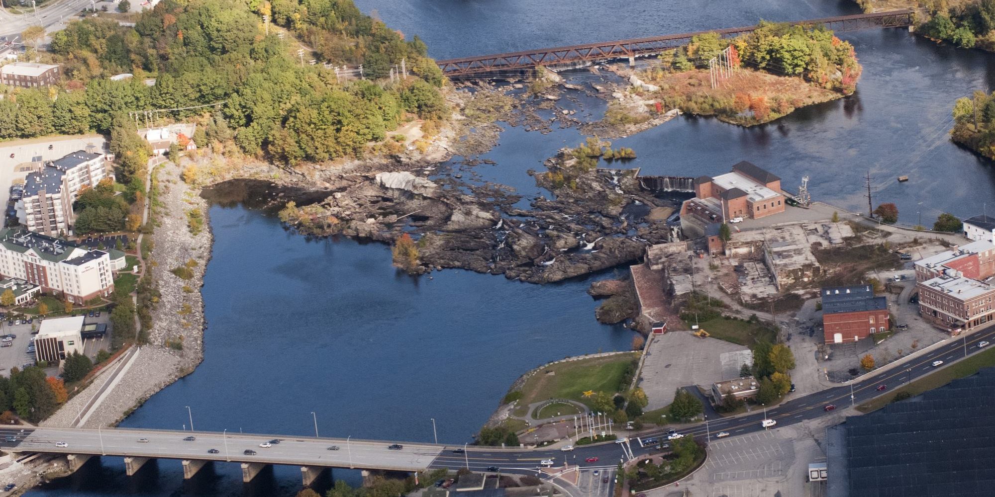
Lewiston Falls
FERC License: 2302
Project Overview
Welcome to Brookfield White Pine Hydro, LLC’s (BWPH) Relicensing Website for the Lewiston Falls Project (Federal Energy Regulatory Commission (FERC) No. 2302) located on the Androscoggin River at river mile (RM) 30.8 in Androscoggin County, Maine in the cities of Lewiston and Auburn. The Lewiston Falls Project (Project) is located on the Androscoggin River in the downtown areas of Lewiston and Auburn, Maine. The Androscoggin River runs 178 miles from Umbagog Lake in Errol, New Hampshire, through western Maine to join with the Kennebec River at Merrymeeting Bay, approximately 20 miles inland of the Gulf of Maine. The Androscoggin River is Maine’s third largest river, with a drainage area of approximately 3,530 square miles.
What's new
The Federal Energy Regulatory Commission (Commission) is currently reviewing the final license application (FLA) filed with the Commission and distributed to Stakeholders in August of 2024, by Brookfield White Pine Hydro, LLC (Brookfield) for the relicensing of the Lewiston Falls Hydroelectric Project (Lewiston Falls Project) (FERC No. 2302).
About Lewiston Falls

Public Safety
During Construction
Please respect all fencing, signage and safety indications;
they are in place to ensure your safety and that of employees
and consultants working on the project.
